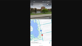
This past Thursday (27) Google announced two new features for Google Maps users: to see in real time - and with more precision - where the bus, subway or train that the passenger wants is and the forecast of its capacity. .
The news was released on the company's blog. In the publication, Google claims that Google Maps "is launching two new features to improve passenger life and planning according to city traffic".
real-time delays
The first novelty brought by Google is aimed especially at buses. "unfortunately, expected arrival times for public transport do not reflect the actual condition of the traffic" and, because of this, many can waste valuable minutes waiting for a bus that is late.
With these people in mind, Google has developed a feature capable of showing if the bus will be late, how long it will be, and a more accurate travel time based on the traffic conditions at that moment.
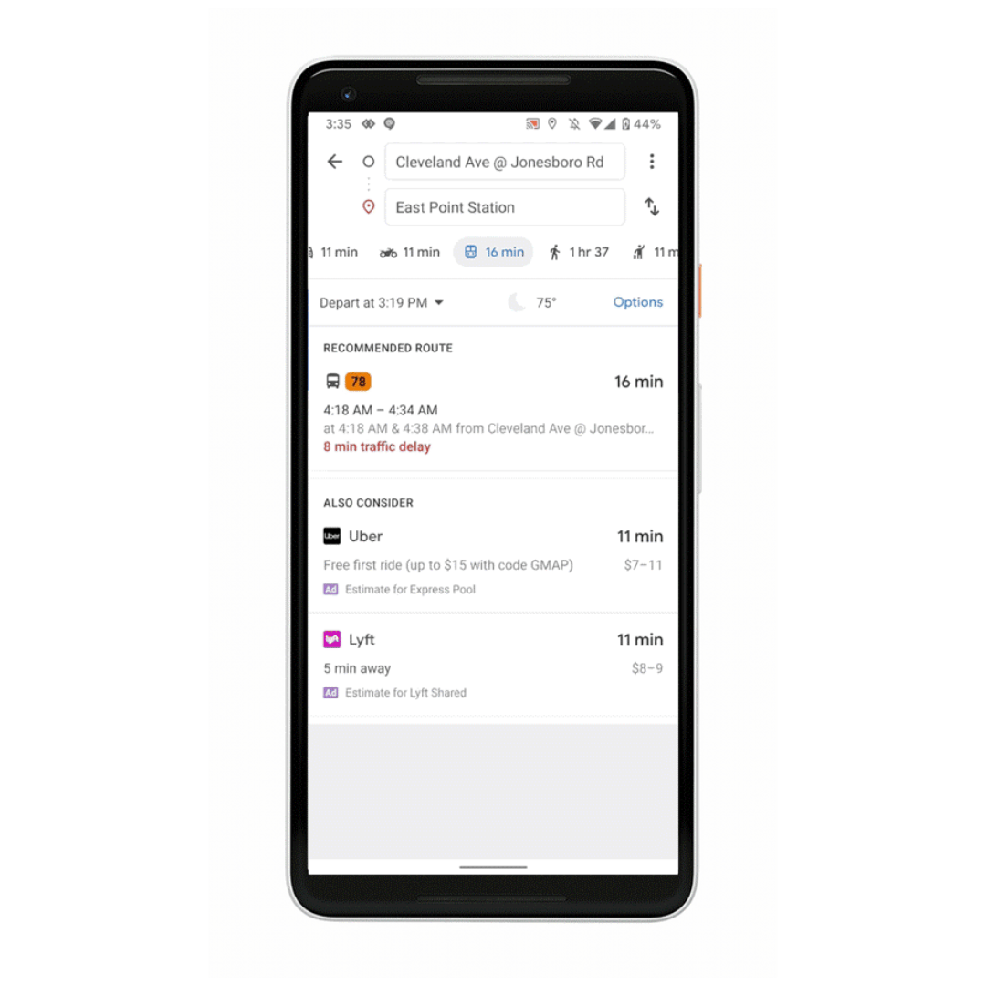
In addition, it is also possible to see where the main traffic peaks are - so that the passenger can get off the bus if they want to.
- 20 Things You Didn't Know Google Chromecast Can Do
- How to download YouTube audio/music without using programs in 2021
capacity forecast
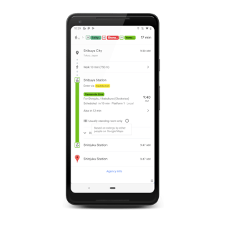
As Google's post says and everyone agrees "there's nothing more uncomfortable than being crushed like a can of sardines on a hot train."
With this in mind, the company developed the "capacity forecast", which allows the user to know how many more or less people are on the bus, train or subway that he intends to take. The feature uses past travel data to predict peak times.
According to Google these news already started running on cell phones since its launch, on Thursday (27), in more than 200 cities. They are available for both Android and iOS.
Source: google blog